
Hurricane Beryl sweeps past Cayman Islands after hammering Jamaica
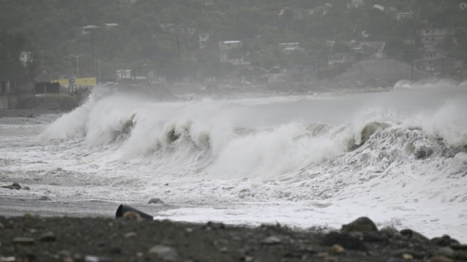
Hurricane Beryl swept past the Cayman Islands Thursday en route to Mexico, threatening to bring gusting winds and storm surge after battering Jamaica's southern coast.
Beryl weakened to a Category 3 storm overnight, and now has maximum sustained winds of 120 miles (195 kilometres) an hour. It is expected to weaken further as it heads toward landfall early Friday on Mexico's Yucatan Peninsula, the US National Hurricane Center said.
The storm has left a trail of destruction across the Caribbean and the coast of Venezuela, killing at least seven people and bringing with it flash floods and mudslides.
The storm is the first since NHC records began to reach the Category 4 level in June and the earliest to reach Category 5 in July.
In the Cayman Islands, Acting Deputy Governor Eric Bush said there have been no calls for evacuations and expressed worry that some people were leaving their homes to film the storm, the Cayman Compass news website said.
In Jamaica, more than 400,000 people were without power, according to the Jamaica Gleaner newspaper, citing a public service company.
Mexican officials have scrambled to prepare, with the NHC warning Beryl will remain a hurricane until it makes landfall.
"We will have intense rains and wind gusts" from Thursday, Civil Protection national coordinator Laura Velazquez said, announcing the deployment of hundreds of military personnel, marines and electricity workers in anticipation of damage.
The government has prepared 112 shelters with a capacity for around 20,000 people and suspended school in the state of Quintana Roo, where Beryl will likely hit.
In towns including the resort Tulum, public activities will be suspended starting at 4:00 pm Thursday. Velazquez urged people to report to the nearest shelter as the storm approaches.
The hurricane is expected to slam the Yucatan as a Category 1 hurricane, emerge over the Gulf of Mexico, then hit the northern state of Tamaulipas, which borders the United States.
It is extremely rare for such a powerful storm to form this early in the Atlantic hurricane season, which runs from early June to late November.
Warm ocean temperatures are key for hurricanes, and North Atlantic waters are currently between two and five degrees Fahrenheit (1-3 degrees Celsius) warmer than normal, according to the US National Oceanic and Atmospheric Administration (NOAA).
UN climate chief Simon Stiell, who has family on the island of Carriacou, said climate change was "pushing disasters to record-breaking new levels of destruction."
S.Lopez--ESF


